
Bristol TN/VA • Kingsport • Johnson City • Southwest Virginia
Aerial Mapping & Drone Surveys
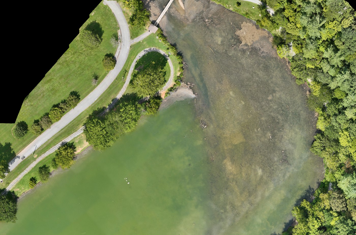
Searching for aerial mapping near you in Northeast Tennessee or Southwest Virginia? We fly grid missions and turn them into orthomosaic maps, 3D models, topographic surfaces, and volume measurements — flown by an FAA Part 107 licensed, fully insured pilot based in Bristol.
- FAA Part 107 Licensed
- Fully Insured
- Safety Focused
Deliverables
What You Actually Receive
Mapping is not just nicer photos from higher up. These are measurable data products your team can work from.
Orthomosaic Maps
Hundreds of overlapping images stitched into one geometrically corrected top-down map of the whole site — sharp enough to measure distances and areas from.
3D Models & Point Clouds
Textured 3D site models and point cloud data you can rotate, section, and hand to your design or coordination team.
Topographic & Elevation Data
Digital surface models and contour output supporting grading, drainage, and site planning decisions.
Volume & Stockpile Reports
Cut, fill, and stockpile volumes measured from the flight data, repeatable on the same flight plan each month.
Drone mapping supports surveyors, engineers, and contractors. It does not replace licensed land surveying, and we do not provide surveying services where that license is legally required.
Common Projects
What Gets Mapped Around Here
- Pre-construction existing-condition capture
- Monthly construction progress maps
- Earthwork and material volume tracking
- Development and subdivision site planning support
- Land, farm, and acreage documentation
- Utility corridor and right-of-way mapping
- Industrial facility and laydown-yard mapping
- Post-storm condition and damage records
Precision
RTK Positioning & Field Discipline
Accuracy on a map starts on the ground, before the aircraft ever leaves the pad.
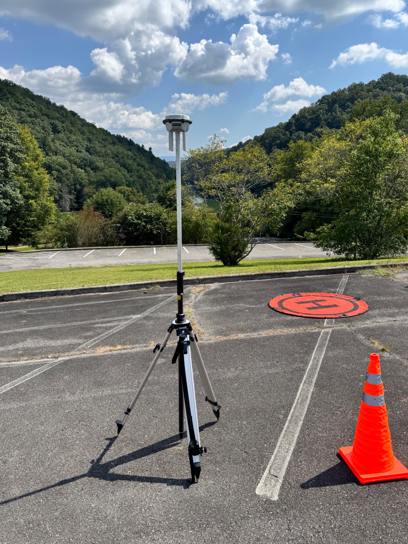
- A D-RTK base station is deployed on site for centimeter-grade relative positioning on every mapping flight.
- Ground control and checkpoint discipline keep the orthomosaic honest — accuracy is verified, not assumed.
- Fixed altitude, overlap, and flight lines are planned in advance so repeat flights match visit to visit.
- The launch area is coned off and documented — professional field procedures are part of the deliverable.
How It Works
Booking a Mapping Flight
- 1Send the site address, boundary, and what the data is for.
- 2We check airspace, request authorization if the site needs it, and plan the grid.
- 3We fly the mission at fixed altitude and overlap, usually in a single visit.
- 4Imagery is processed into your deliverables and delivered as downloadable files.
Scope & Cost
What Drives the Price
- Small sites (a few acres) are typically a single short flight.
- Large sites and corridors take multiple batteries and longer processing.
- Recurring progress programs are priced per visit and get cheaper per flight.
- Turnaround for processed data is normally a few business days.
Send the site boundary and we will quote the actual flight rather than a generic rate.
Commercial Site Intelligence
From $995Land and parcel marketing mapping starts at $495. Construction progress programs start at $650 per visit. Engineering, utility, and public-sector work is quoted custom. Starting prices are guidance only — final quotes depend on scope, site access, airspace, schedule, requested deliverables, current operating costs, tariffs/import duties, and unforeseen conditions.
Where We Map
Aerial Mapping Near You
City-specific mapping and photography pages across the Tri-Cities and Southwest Virginia.
Get Started
Request an Aerial Mapping Quote
Tell us the site location, rough acreage, and which deliverables you need. We reply by email — typically within one business day.