
Bristol TN/VA • Johnson City • Kingsport • Tri-Cities
Real Estate Drone Photography in the Tri-Cities
Aerial photography and video for homes, land, and commercial property across Northeast Tennessee and Southwest Virginia. Tri-Cities Aerial Solutions is a Bristol-based, FAA Part 107 licensed and fully insured drone operator working with agents, brokers, builders, and property owners.
- FAA Part 107 Licensed
- Fully Insured
- Bristol TN/VA Based
Property Marketing
Show the Property, Not Just the Building
Ground photos stop at the front door. Aerial coverage shows the lot, the acreage, the access, and the setting — the details buyers ask about before they ever schedule a showing.
- High-resolution aerial stills, edited and ready for MLS, print, and web
- Aerial video clips for listing tours, social media, and property websites
- Straight-down top-down frames that show the full parcel shape and setting
- Approach and context shots showing road frontage, access, and neighboring use
- Orthomosaic parcel mapping where a listing needs a measured-looking top-down view
Property Types
Residential, Commercial, Land & Development
Every property type is flown with the same licensed, insured, safety-first process — the deliverables change with the audience.
Residential Listings
Elevated stills and video that show the house, the lot, the driveway approach, and the surrounding neighborhood in frames a ground camera cannot reach. Useful for agents, builders, and owners selling homes with a view, a setting, or land attached.
Commercial Real Estate
Retail centers, office and industrial buildings, and investment property captured for listings, brochures, and offering memorandums — including access, parking, loading, and adjacency to main roads.
Land & Acreage Marketing
Acreage, farms, timber tracts, and recreational land are difficult to convey from the road. Aerial coverage shows shape, terrain, tree line, water, road frontage, and how the tract actually sits.
Development Property
Development sites, subdivisions, and raw commercial land documented for planning conversations, investor packages, and marketing — with top-down context showing site layout and surroundings.
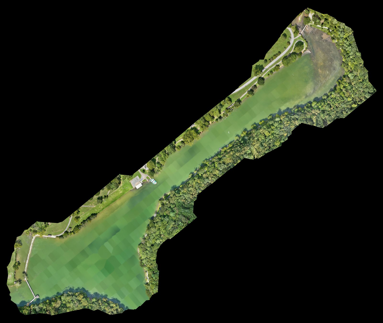
Top-Down Parcel Presentation
Orthomosaic Parcel Views for Land Listings
For land, acreage, and development listings, we can add a stitched top-down orthomosaic of the property — a flat, distortion-corrected overhead image that shows the whole tract at once instead of a single angled photo.
Orthomosaic and mapping imagery is a visual marketing and documentation tool. It is not a boundary survey and is not a substitute for licensed land surveying.
How It Works
From Address to Published Listing
- 01
Send the property address and tell us what the imagery is for — listing, land sale, or a commercial package.
- 02
We check airspace, weather, and site access, then confirm a flight window that fits your listing schedule.
- 03
We fly the property as a Part 107 pilot with commercial insurance in place.
- 04
You receive edited photos and video ready to publish, usually within a few business days.
Service Area
Local Coverage Across the Tri-Cities
Based in Bristol and flying property work throughout Northeast Tennessee and Southwest Virginia.
- Bristol, TN
- Bristol, VA
- Johnson City, TN
- Kingsport, TN
- Blountville, TN
- Abingdon, VA
- Elizabethton, TN
- Greeneville, TN
- Northeast Tennessee
- Southwest Virginia
Listing in a town not shown here? Ask — most of the region is within a comfortable drive of Bristol.
Pricing for Property Photography
From $495Starting prices are guidance only. Final quotes depend on scope, site access, airspace, schedule, requested deliverables, current operating costs, tariffs/import duties, and unforeseen conditions.
Request a Quote
Get Your Property in the Air
Tell us the address, the property type, and when the listing goes live. We'll come back with scope, scheduling, and deliverable options.