
Mapping & Inspections
Aerial Data, Not Just Imagery
Photogrammetry, orthomosaic mapping, 3D deliverables, and high-resolution inspection imagery for construction, engineering, utility, roofing, and municipal projects.
Request a QuoteMapping
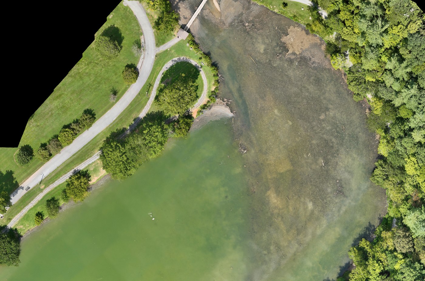
Mapping & Photogrammetry
Drone-based mapping for construction, development, land management, planning, and commercial applications — delivered in formats your team can work with.
- Orthomosaic maps
- 2D site maps
- 3D models
- Point clouds
- Site documentation
- Progress comparison over time
- Measurement support
- Volumetric analysis where appropriate
- Stockpile documentation
- Existing-condition documentation
Drone mapping and measurements can support surveyors, engineers, contractors, and other professionals. We do not provide licensed land surveying, and our work does not replace professional engineering or surveying services where those licenses are legally required.
Mapping Pricing
From $995Starting prices are guidance only. Final quotes depend on scope, site access, airspace, schedule, requested deliverables, current operating costs, tariffs/import duties, and unforeseen conditions.
Inspections
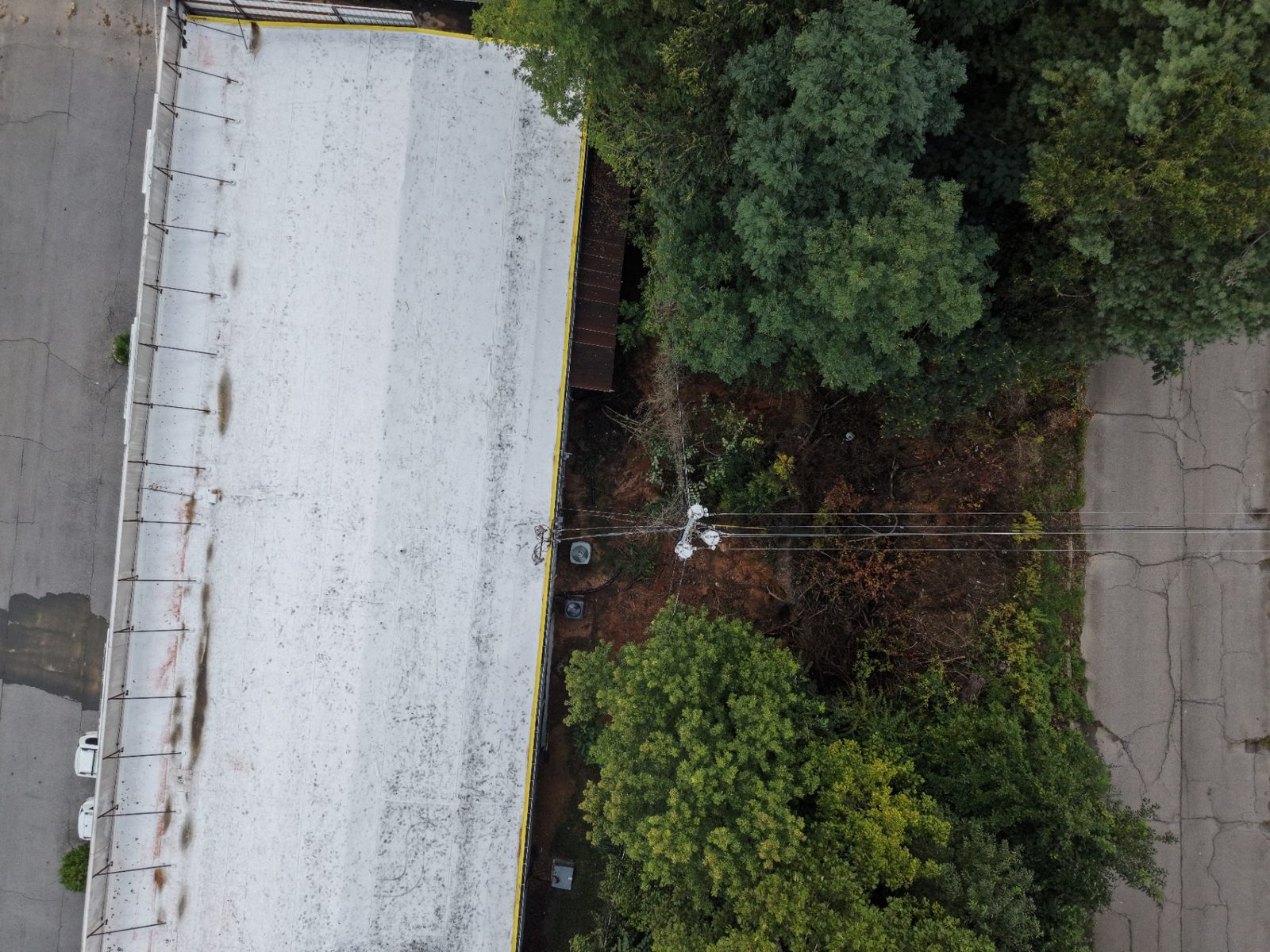
Roof & Building Inspections
High-resolution aerial inspections that document roofs and structures while reducing the need for unnecessary ladder or roof access.
- Roof condition documentation
- Commercial and residential roofs
- Storm damage documentation
- Insurance-related imagery
- Hard-to-access areas
- Exterior building inspections
- Façade documentation
- Gutters, flashing, vents, chimneys, and rooftop equipment
After severe weather, see our storm damage assessment work.
Inspection Pricing
No fixed public rate applies to this work. Starting prices are guidance only. Final quotes depend on scope, site access, airspace, schedule, requested deliverables, current operating costs, tariffs/import duties, and unforeseen conditions.
Infrastructure Inspections
Drone imaging and documentation for infrastructure and difficult-to-access assets, coordinated around site access, airspace, and safety requirements.
- Bridges
- Towers
- Utility infrastructure
- Roads
- Construction sites
- Industrial facilities
- Structures
- Municipal assets
Construction Progress Monitoring
Recurring flights that document a project from beginning to completion, captured from the same viewpoints each visit.
- Weekly or monthly progress flights
- Consistent aerial viewpoints
- Site documentation
- Owner and investor updates
- Contractor documentation
- Before-and-after comparisons
- Project milestone documentation
- Marketing content
Also Available
Thermal Inspection & Advanced Aerial Imaging
Our DJI Matrice 4T captures visible and thermal imagery for roof, building, infrastructure, utility, facility, and inspection-support applications. Thermal patterns indicate where qualified follow-up evaluation may be warranted; they are not a diagnosis by themselves.
Next Steps
Schedule a Drone Mission
Tell us the site, the timeline, and the deliverables your team needs. We'll confirm airspace, scope the flight plan, and get your data collected safely.