jason@fly-TCA.comService Area: Tri-Cities
Actual T-CAS aerial reference photograph of a commercial roof and adjoining site

Tri-Cities Aerial Solutions / Bristol TN/VA

Aerial Services &
Property Intelligence

See the property. Follow the progress. Keep the record.

Real aerial imagery and useful site context for owners staying informed, teams tracking construction and people presenting land. Start with one project—or define a recurring observation program.

FAA Part 107 Licensed & Fully Insured · Northeast Tennessee & Southwest Virginia

Actual T-CAS roof documentation / No condition finding is represented

Three needs. A practical aerial perspective.

Better context for your next decision.

The deliverable should answer your question—not simply demonstrate what an aircraft can do.

Property owners

Stay informed, even from a distance.

See accessible exterior areas, roof context, entrances and visible contractor activity without relying on scattered updates. Dated photographs and agreed comparisons create a useful record for maintenance conversations and qualified follow-up.

An organized owner record of what was visible, when it was captured and where coverage was limited.
Construction teams

Keep progress in perspective.

Capture the site at agreed milestones and repeat viewpoints where practical. Share aerial photographs and scoped mapping with owners, contractors and stakeholders so everyone can review the same visual context.

Progress image sets and available before-and-after comparisons—not certification of workmanship or completion.

Realtors & landowners

Show the acreage, not just the entrance.

Present open space, vegetation, access and the relationship of land to its surroundings. Aerial marketing imagery helps people understand a property; separately scoped mapping and 3D views add site context when useful.

Listing and land-presentation imagery. Mapping is separately scoped; no legal boundary or acreage certification.

Actual public T-CAS examples

From a photograph to a fuller view.

Existing roof imagery, public Steele Creek mapping and anonymous reconstruction examples show the kinds of visual records we can scope for your site.

View Mapping Example
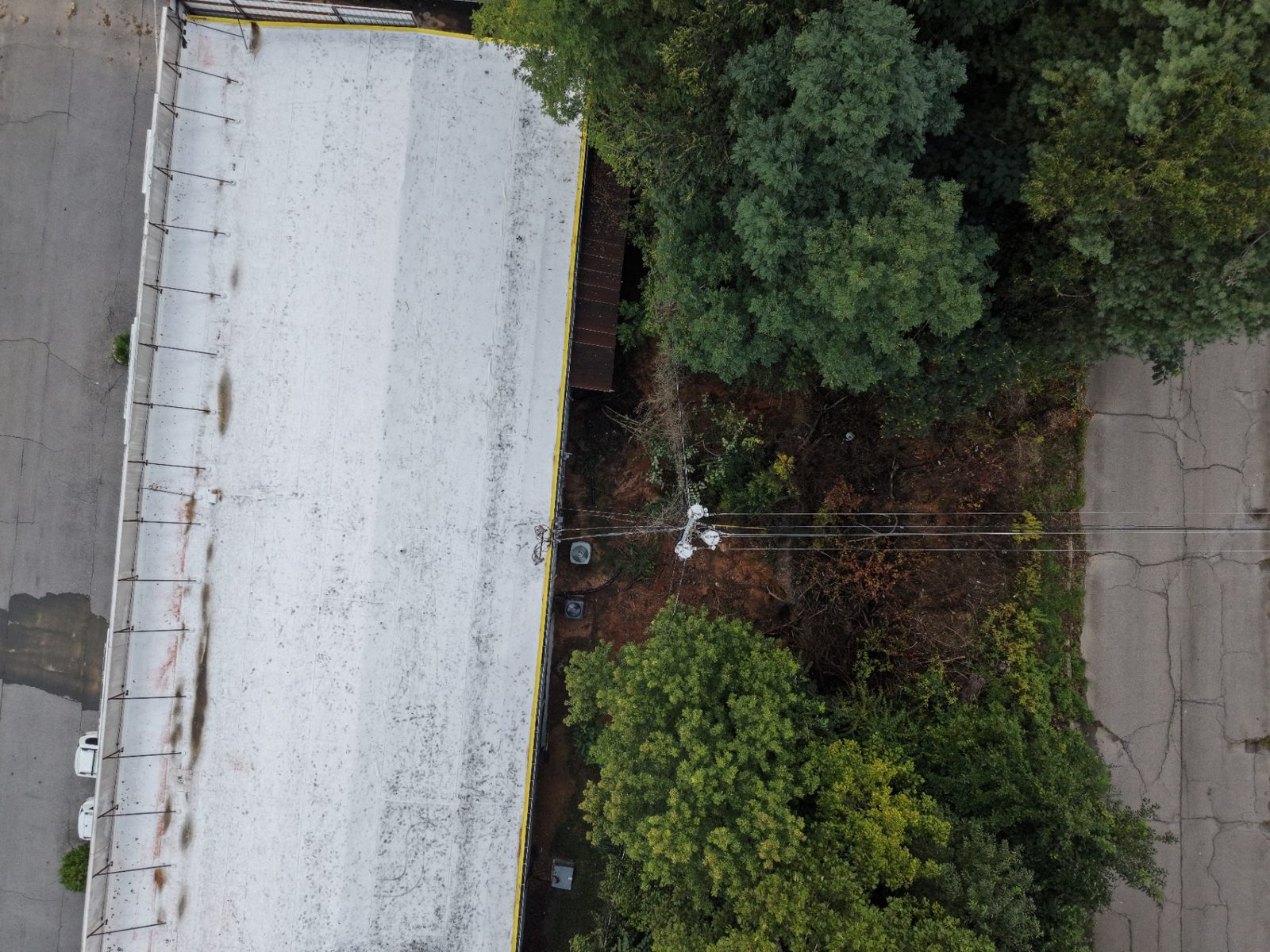
Actual T-CAS overhead photograph of a commercial roof and adjoining site

01 / Exterior visual record

Roof & site context

Aerial views relate roof surfaces, rooftop equipment and nearby access areas. A project record adds the real capture date, coverage notes and agreed labels.

Actual T-CAS public roof imagery. A visual reference, not an asserted defect or inspection finding.

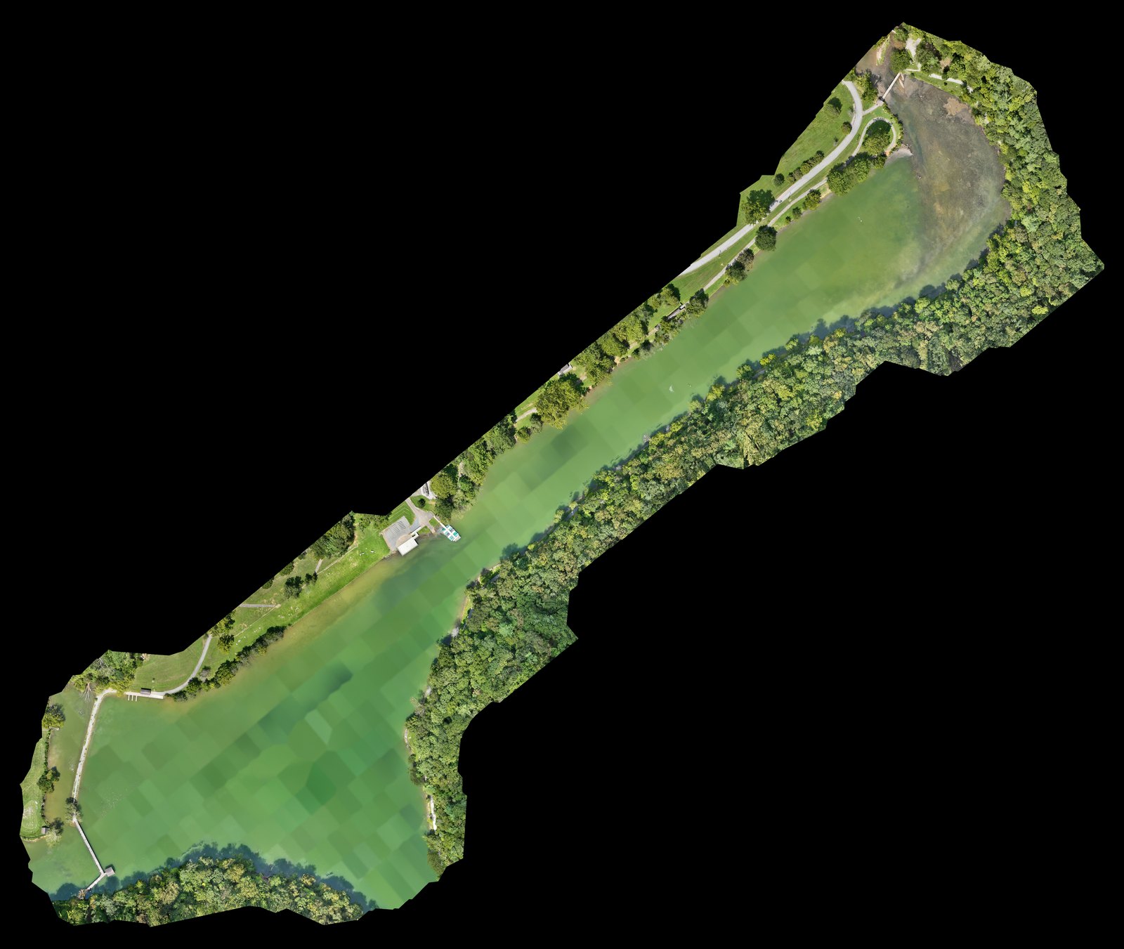
Public T-CAS Steele Creek stitched overhead orthomosaic showing the site and its surroundings

02 / Georeferenced orthomosaic

One coherent site view

Stitched aerial captures form a georeferenced overhead image for site review and communication. Coordinate reference, coverage and export format are agreed for the project.

Existing public Steele Creek orthomosaic. A mapping example, not a monitored owner property.

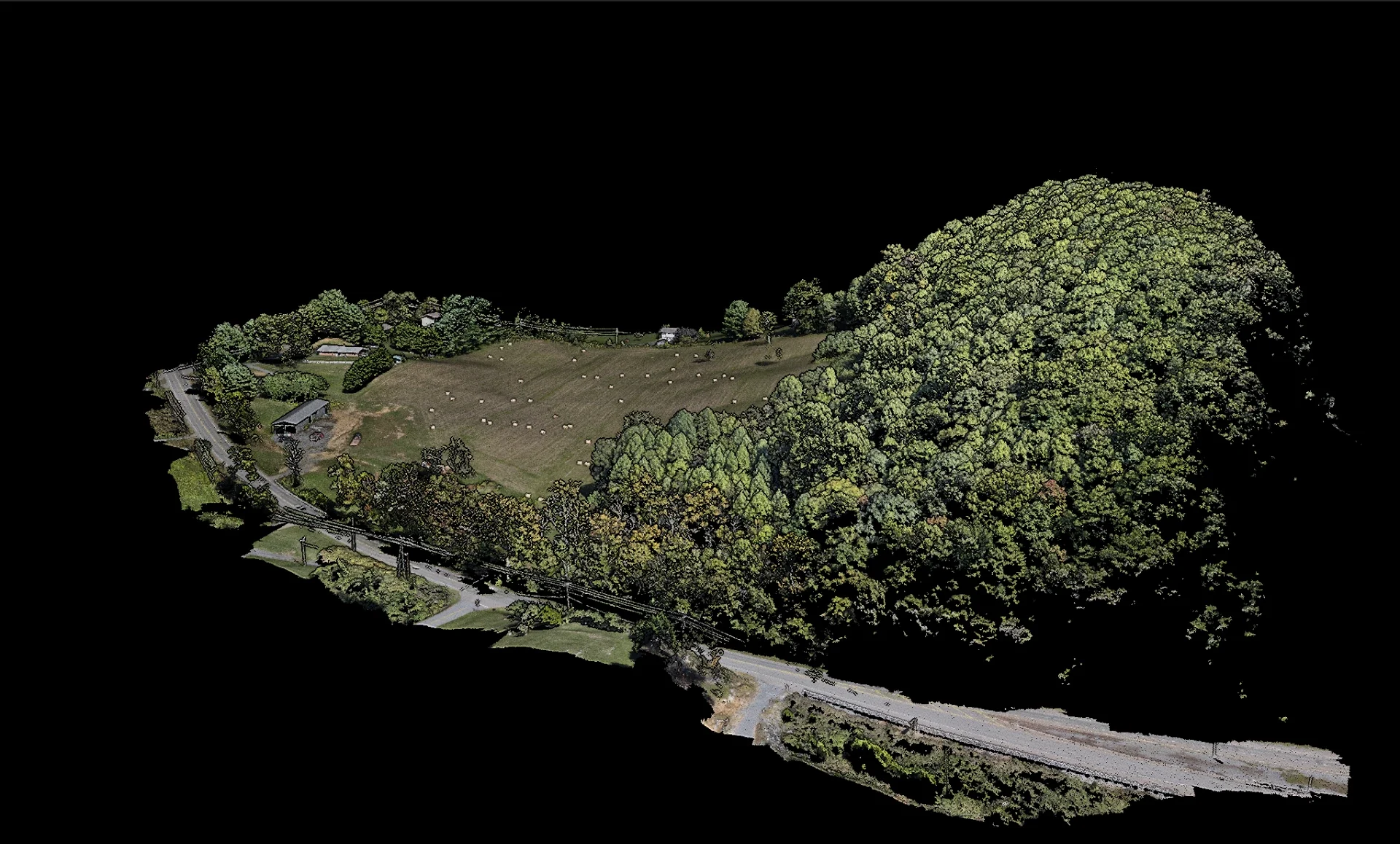
Anonymous public T-CAS textured 3D reconstruction of terrain, buildings and vegetation

03 / Textured reconstruction

Spatial context in 3D

Review terrain, structures and access relationships from another angle. Scoped deliverables may include model perspectives or agreed reconstruction files; not every photo flight produces a model.

Public anonymous mapping demonstration / textured 3D perspective.

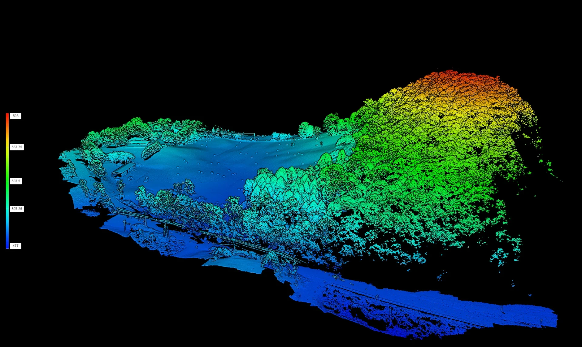
Anonymous public T-CAS colorized elevation visualization of a reconstructed site

04 / Elevation visualization

Understand the shape of the site

Colorized surface views show relative height changes for planning conversations. Vegetation and structures can affect the surface model; this is not a certified bare-earth survey or drainage analysis.

Public anonymous mapping demonstration / colorized surface-height context.

These are public capability references, not new customer findings. Mapping and elevation outputs support visualization and documentation; they do not certify boundaries, accuracy or engineering conclusions.

What you receive / As agreed in scope

Useful files. Clear context. An organized handoff.

Select the outputs you actually need. A one-time imagery project and a multisensor mapping assignment do not carry the same deliverables.

Dated visual records

Organized aerial and agreed ground photographs, actual observation dates, repeat viewpoints where practical, and notes on access or capture limitations.

Georeferenced orthomosaic

A stitched top-down site image with agreed coverage, coordinate reference and file format, when mapping is part of the written scope.

3D & elevation context

Textured model views, colorized surface-height perspectives and agreed exports where capture and processing support them.

Organized private delivery

Labeled project folders, agreed downloadable files and controlled project access where scoped. Reporting, access and retention arrangements are defined before delivery.

Thermal documentation can be added where agreed and capture conditions are suitable. It records apparent surface-temperature patterns for qualified follow-up—not a diagnosis or guaranteed roof-moisture detection.

Choose the engagement, then define the scope

One project or an ongoing record?

One-time project

A defined capture and delivery.

A land-presentation image set, a site-mapping assignment or a construction-progress visit. Agree the area, timing and output; receive that project’s record. No future visits or ongoing oversight are implied.

Proposed recurring program

A history built over agreed visits.

Start with a baseline, then use agreed visual observations, reporting and any included mapping or thermal work to review change. Visit allowances, intervals, access and reporting are set in writing—not assumed from a monthly price.

Standalone project starting rates

Start with the work you need.

Approved starting prices for discrete projects. Final coverage, deliverables and price depend on the written scope.

Land & development marketing

From $495

A discrete aerial imagery project to present land, development sites and their surroundings. Image selection and coverage are agreed; mapping, thermal and recurring oversight are not included automatically.

Discuss This Project

Commercial mapping

From $995

A scoped site-mapping project. Agree the orthomosaic coverage and formats first; 3D, elevation and additional exports depend on the written quote, not an assumed all-in package.

Discuss This Project

Construction progress

From $650 / visit

One agreed progress-documentation visit with an organized visual record. Further visits, mapping and specialist deliverables are separately agreed; no schedule or monthly program is implied.

Discuss This Project

The $495 starting rate is for land and development marketing; it is not a blanket price for every real-estate photography assignment. Site size, travel, access, airspace, timing and requested outputs affect the quote.

Proposed recurring service levels

Choose the depth of your property record.

Indicative monthly starting rates, subject to scope—not signed quotations or contractual offers.

01 / Proposed program

Property Watch

$695/mo

Starting rate · Subject to written scope

A consistent visual record.

  • Proposed recurring visual observations
  • Exterior and access-area photography
  • Contractor activity documentation
  • Organized photographic reporting

Visual observation only. No thermal, mapping or vendor coordination.

Discuss Property Watch

02 / Proposed program

Property Intelligence

$1,495/mo

Starting rate · Subject to written scope

More context. Better-informed decisions.

  • Everything in Property Watch
  • Scoped Matrice 4T thermal anomaly screening
  • Scoped Matrice 4E site mapping
  • Repeat-observation comparisons

Thermal and mapping have negotiated limits. No vendor coordination or unscoped extra visits.

Discuss Property Intelligence

03 / Proposed program

Property Intelligence 360

$2,495/mo

Starting rate · Subject to written scope

A broader view of your property.

  • Everything in Property Intelligence
  • Coordinated multi-modal visual, thermal and mapping program
  • Orthomosaic, 3D context and contractor progress records
  • Owner record concept with secure historical deliverables

Broader negotiated multisensor and reporting scope. No unlimited visits, emergency response or live subscription portal.

Discuss Property Intelligence 360

No fixed visit frequency or response obligation is promised. Mapping, thermal, ground checks and owner-authorized vendor coordination are included only where expressly agreed. Major project deliverables and add-on work require a separate agreement when outside the allowance.

  • Each level includes only its written allowance; work outside it is quoted separately.
  • Standalone project flights are discrete deliverables, not a substitute for a monthly level.
  • Overlapping booked work is credited or bundled, never billed twice. Discounts do not automatically stack.

Capture → organize → review

A record you can return to.

Agree your questions, access, capture area and files first. Document the baseline, deliver the scoped outputs, and review available comparisons when repeat visits are booked.

For a recurring property program, a proposed 90-day pilot offers a way to review the usefulness of an agreed observation and reporting scope. It is a recommendation, not a mandatory commitment.

Owner portal: concept only. An owner command center remains a demonstration idea, not a live subscription dashboard. Scoped private project delivery is separate and does not imply deployed monitoring software, live metrics or automatic alerts.

Purpose-built aerial capability

Three aircraft. One informed view.

The right capture method for the question your property presents—not one aircraft for every job.

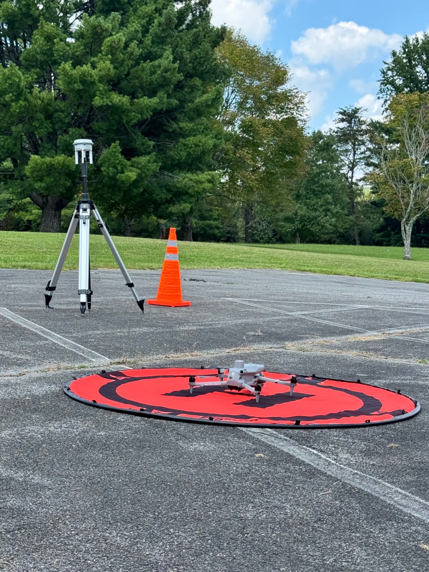
T-CAS Matrice 4E on a launch pad with an on-site D-RTK base station
Actual T-CAS field setup / Matrice 4E + D-RTK 3

01 / Thermal + detailed visual

DJI Matrice 4T

Thermal anomaly screening and stand-off visual observations help identify areas for qualified follow-up.

02 / Orthomosaic + 3D mapping

DJI Matrice 4E

Our primary mapping aircraft captures the imagery behind georeferenced orthomosaics and 3D site reconstructions.

03 / Visual monitoring

DJI Mini 5 Pro

Visual property monitoring and photographic progress records support repeat exterior observations.

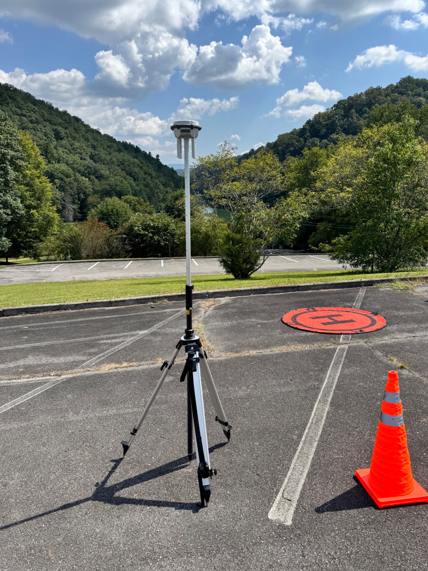
T-CAS D-RTK 3 base station set up at a mapping site

Positioning support

D-RTK 3 / Consistency across observations

On-site RTK corrections support georeferenced mapping and repeat property observations. Accuracy depends on capture, control and processing; this does not constitute licensed surveying or engineering.

Before you decide

Clear scope. Realistic expectations.

Bristol TN/VA · Johnson City · Kingsport

Show us the site. Tell us what matters.

A property update, a construction milestone or land you need to present—we’ll discuss the capture, deliverables and practical scope with you.